Photos by Jack A. Waldron
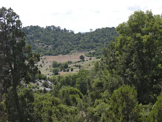
Cycling through the western Taurus Mountains north of ancient Aspendus and ancient Selge, then crossing into the prefecture of Isparta via Kesme to Kasimlar, then on to ancient Adada, reveals some of the most spectacular views of what was once known in ancient times as Pisidia.
Though it was the middle of June, the mild mountain weather could turn to freezing rain within hours, and being caught in the mountains under such circumstances without time to set-up camp, I think this was the first time in my life that I gained an understanding of why so many ancients worshipped the sun, as you can truly feel its life giving powers, when an unbearable freeze has driven you to huddle and sleep for warmth. I was hard pressed to search for ancient Zorzila/Zorzela under these harsh conditions, so I pressed on to Kasimlar; truth be told, it was more a result of my lack of due diligence in preparation for this journey that I missed the ancient city of Zorzila/Zorzela.
*Note: My first tour through this area was in 2015, and I have since returned to Kasimlar and Kesme. It always bothered me that I could not locate ancient Zorzila/Zorzela. I have since been able to locate and explore what I believe to be ancient Zorila/Zorzela on a mountain above Kesme, and I promise, I will write about this magnificent site in the future. Also, I was able to explore an ancient site just 5 kilometers outside of Kasimlar, that is sometimes labeled as Zorzila/Zorzela, and I will write about that site as well.
I finally reached a small shop/grocery/tea house, where I sought refuge from the freezing rain. There was an old man and his wife who invited me in from the rain. After a couple hours, it became obvious that I wasn't going to be able to go on . . . , the evening was upon us. The roof of the shop was flat and perfect to set-up camp. They brought me some food, I drank a beer, and the next I knew the hot morning sun was rousting me out of my confines.
The route that traverses the mountains from northeast Antalya prefecture to southeast Isparta prefecture finally reaches this lonely pass. For many many kilometers the road was in a very poor state, ranging from gravel to patchy potholed pavement to dirt. There are very few cars along this route, however, gravel and marble carrying trucks pound their path at breakneck speeds leaving this unprotected cyclist in clouds of dust . . . , oh, the joy to be alive!!
The climbing never ends, and sometimes it's time to get off the bike and push! The climb to ancient Kasimlar took about two and a half hours. One might think that this mode of travel is unbearable or, a waste of time, but to the contrary, this is a most wonderful way to exercise, be one with nature instead of speeding past it, slowing the road of life: I was cycling for ten weeks this past summer, and I can remember nearly every moment of every day down to the hour, but, I cannot even remember my work days of the past week.
When I arrived at the first remnants of the village of Kasimlar, I saw steep path lined with a few scant antiquities that led up to a small park with slides and swings, and a clean public toilet.
I pushed my bike up several tens of meters before arriving at a lookout over the entire village of Kasimlar (pictured above), and a spot that looked out over the valley I had just come out of (pictured below).
The quiet of Kasimlar was broken only by the birds of the valley, occasional voices of local children far off in the distance, and of a sheep herding woman talking to her flock, and the flock in turn answering her calls (see/hear video above).
Though there are only a few column barrels and various other scant remains of the ancient city, it could have been 100 BC that night, and nothing would have been different, except the sparse lamps spread across the village (pictured below). I was told by some villagers that the modern village is built on top of the ancient remains, covering it in full.
The evening solace of my camp was so impressive that I truly considered staying another night, however, because my mission is to visit as many ancient cities as possible while on tour, I felt a strong urge to move on down the road, or, as I would find out the following morning, up uP UP the road!
I used to think I would avoid mountains as much as possible, and why I began my 2015 season by going directly into the mountains I do not know, however, as I went along I discovered that I love cycling in the mountains, and would never let them force me to adjust a route. Now I was on my way to ancient Adada (near Sagrak), which I had only found out about a few weeks prior to my departure. Adada is an ancient city that is not on the must see lists of book guides or tourist itineraries, and after having visited this ancient city I think this an overlooked gem.
I climbed higher and higher from Kasimlar until I reached an extremely deep valley that saw the road twist and turn down steep paths to the bottom only to be greeted with a climb up similar terrain. This was the passage through the range as I began to cycle toward the Kasimlar Yolu Plateau and beyond to Adada (near Sagrak). Along the way, the smattering of houses, barns and seed huts of a bygone era begged to be recorded for posterity (I hate this sort of fantastical writing style . . . "begged", really! LOL).
The Kasimlar Yolu Plateau is truly a magical place, with herds of horses roaming across your path and studs biting and chasing opponents away from their captive mares. No houses or buildings, just fresh cold water springs as the plain leads to the hard to find off shoot to ancient Adada through the very small village of Yenikoy.
Barns of Yenikoy (pictured above and below).
The road from Yenikoy to ancient Adada was a long slow meandering down sloping path along the edge of Kovada Golu Milli Park, and was such a welcomed experience after a morning of climbing. Isparta's culture takes one back in time to our roots as western Europeans.
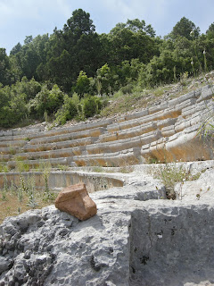
As I had been told by some locals that Adada was about ten kilometers further on, I tried to keep an eye out for any hint of the ancient city. Finally, as I defended from the plateau I could the ancient theater far off in the distance about two hundred meters from the road (pictured above).
The roughly 3000 capacity theater appears to be of Roman design, probably built in the 1 C AD.
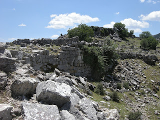
The greater area surrounding the theater have yet to be excavated, and vast fields are sure to reveal numerous buildings and other antiquities.
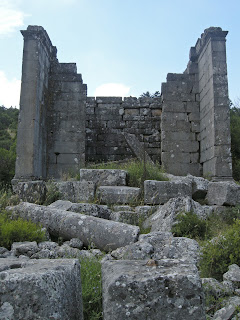
The temple of Trajan sits about fifty meters from the road on the opposite side of the road from the theater. Among the brilliantly preserved temples on the site, the temple of Trajan is the most dilapidated of them.
The information board for the temple states that it was probably built in order to be dedicated to Trajan upon his probable visit in 114 AD. The site is fairly well signposted, which makes one wonder why the ancient city of Adada is so ignored by guide books and enthusiasts.
Pictured below, a very well preserved information board with its antiquated English grammar, though, hats off to those who were given the responsibility to produce it at a time when the country was not awash with native English speakers. Pictured above, the updated version (hope I don't make any grammar mistakes!!).
The well preserved temple of the God-Emperors sits approximately one hundred meters from theater on the same side of the road. I never expected to find buildings in such a fine state of preservation at Adada. I was truly taken aback.
Inside the temple of the God-Emperors (pictured above), and the well preserved back of the same temple (pictured below).
The temple of the God-Emperors from a distance with my bicycle for scale sitting next to it, and the temple of Trajan across the road in the far distance. Wild flowers cover the fields!!
The temple of Emperors and Zeus Megistos Serapis is another very impressive building in a fine state of preservation, and sits about fifty meters from the temple of the God-Emperors. Under the giant pile of building members in front of the temple sits the alter and staircase leading to the pronaos. When all the members are reconstructed, the pronaos and temple will stand nearly complete minus the roof.
An inscription on an architrave/epistyle of the building reveals the dedication of the temple, its benefactors, and approximate building period based on the information given.
The door columns of the pronaos of the in antis building are angled in situ (pictured above), while the right corner member of the cornice lay atop the crumbled pile in front of the temple (pictured below).
Under the giant pile of building members in front of the temple sits the alter and staircase leading to the pronaos. When all the members are reconstructed, the pronaos and temple will stand nearly complete minus the roof.
Leaving the temple complex and heading further down the road toward the central agora brings us to a Roman building just a few feet off the road, which was most likely an administrative building as described by surveyors of the site.
As the main road runs through the center of the site, and as there are no fences around the city, there is no entrance fee and one is free to explore the landscape and inner buildings without restraint.
A tower rises above the public steps of the agora. There are rarely other people exploring ancient Adada, and this allows a visitor to sit and peacefully ponder the workings of the city, as well as how and where the people of this city once sat, walked, worked, talked and fought.
From the agora, there is an inspiring view over the valley and the village of current day Sagrak.
As I said previously, I found out about Adada only weeks before, and I had read of a woman who had travelled through here, and who had spent the night at the now defunct school house (as there are too few children in the village these days, and now attend school in Sutculer, about ten kilometers from Sagrak). Well, I decided to try to do the same, as I had been camping every night for about a week. In the end, the school was not offered as it had been for her (with breakfast!), and I was directed to a farm compound and told it was 50 Turkish Lira, which isn't a large amount of money, but, I went on and finally camped in a beautiful site not far past Sagrak. The site is a summer picnic area that had not yet opened and is located halfway between Sagrak and Sutculer. I was given a delicious plate of BBQ chicken by the neighboring campers, such hospitality in Turkey.
*All photos and content property of Jack A. Waldron (photos may not be used without written permission)
**Please support my work and future postings through PATREON:
Or, make a Donation through PayPal:


