
Photos by Jack A. Waldron

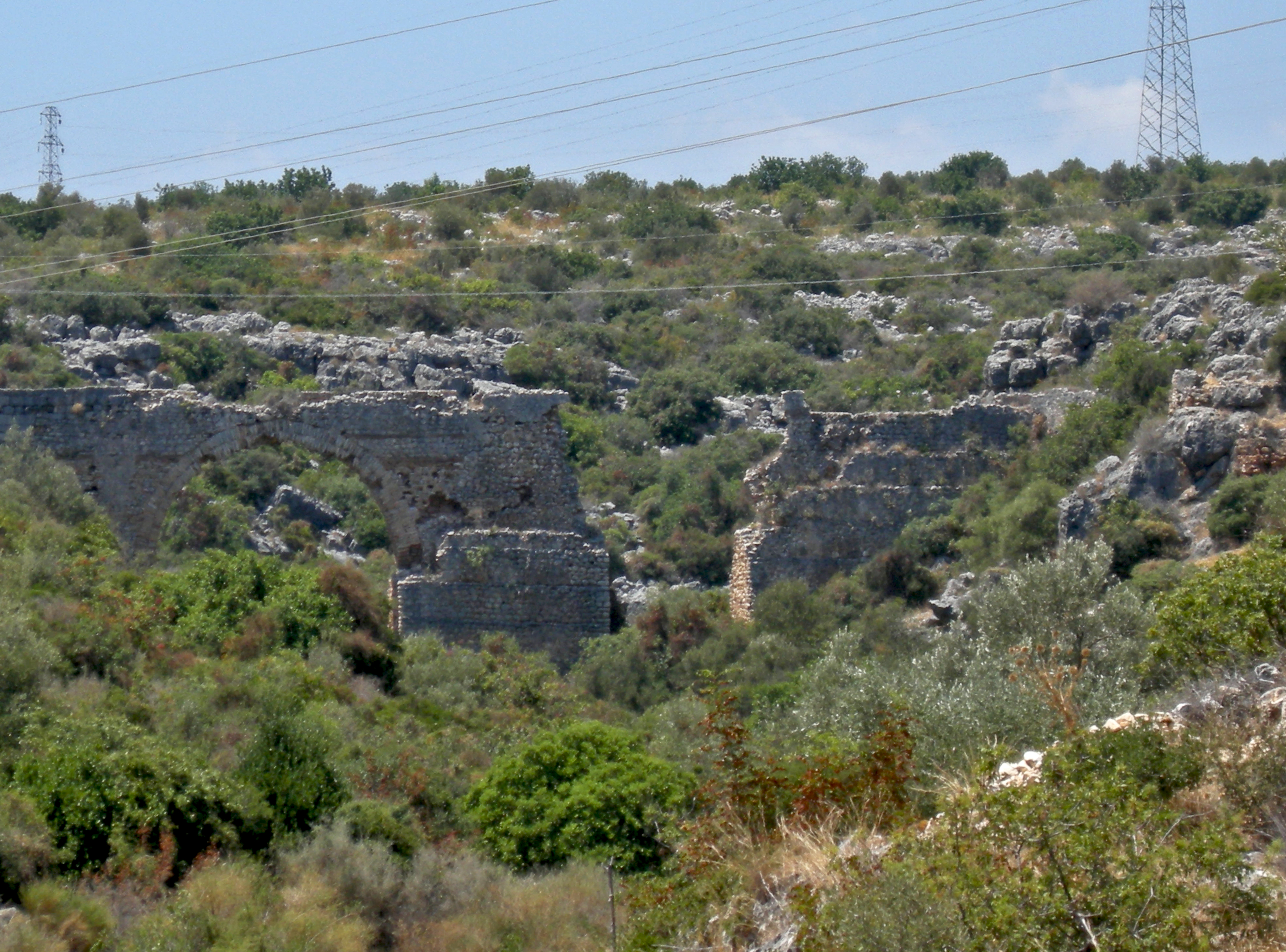
As far as I know, there are supposed to be seven aqueducts along the Turkish Cilician coast between the ancient Lamus River (modern Limanlu River) to the northeast, and the ancient city of Korykos, or Corycus to the southwest. I managed to photograph four of them as I cycled south toward ancient Elaiussa Sebaste and ancient Korykos. I have since been able to locate a total of five aqueducts along this watercourse, but two of the seven aqueducts remain elusive. Pictured here (above and below) is what I am calling Aqueduct 2 (36°31'10.0"N 34°12'07.0"E), or the Kanli Divane Road Aqueduct, that when seen from the main road looks easy to access, but that is not the case.

As a side note, Aqueduct 1 (36°33'22.7"N 34°13'54.4"E), which I did not photograph, is located about 5 kilometers northeast of Aqueduct 2, and about 700 meters up stream from the ancient city of Antiochia Lamotis. The sketch below is of Aqueduct 1, as seen by Victor Langlois sometime between 1852 (Book: Rapport Sur l'explorationde la Cilicie et de la Petite-Armenie pendant les annoys, 1854), and 1861 (Book: Voyage dans la Cilicie et dans les montagnes du Taurus, 1861).
_p283_-_VUE_DES_RUINES_D'_LAMAS.jpg)
Although I didn't learn about Aqueduct 1 until after my journey, the good news is, since I am living near the coast on my sailboat LABRYS, I will return to explore Rough Cilicia once again! Soon!!

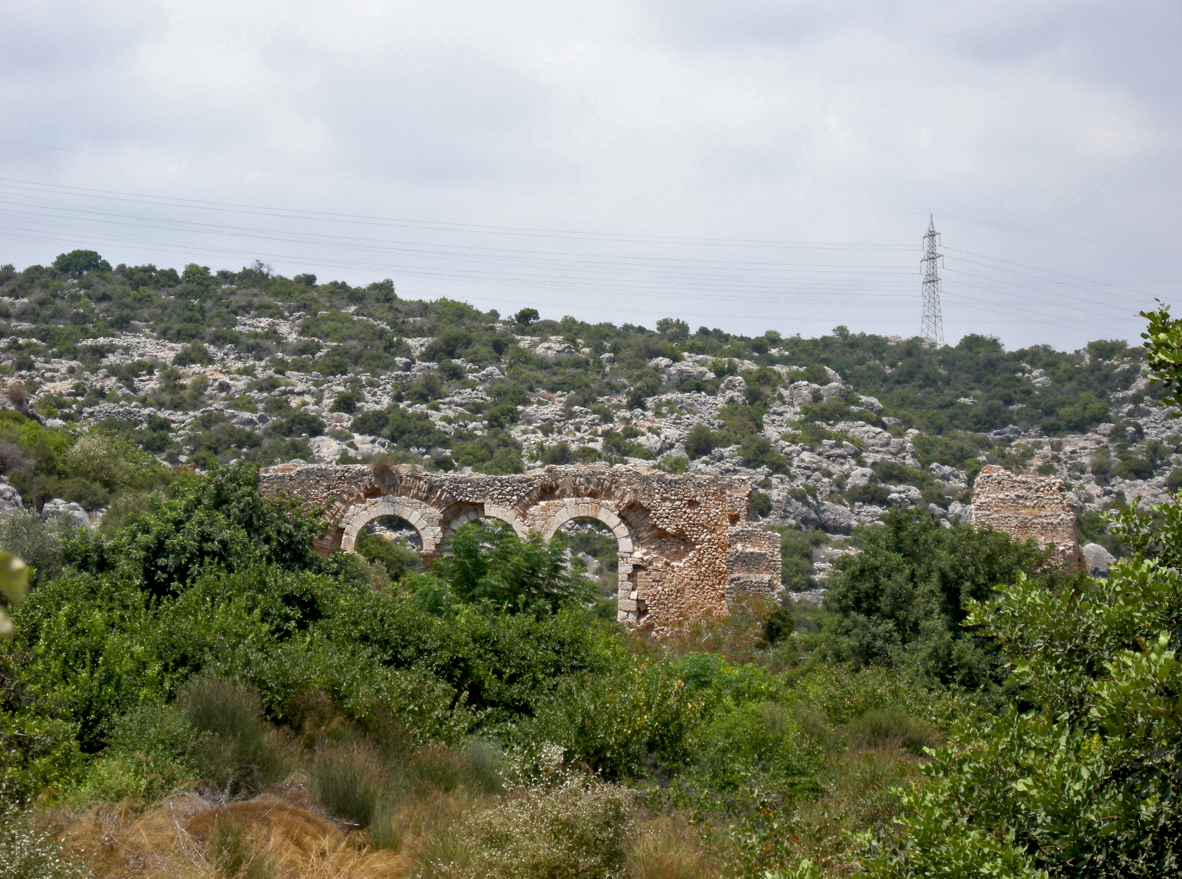
Back to Aqueduct 2, the only way to reach this site from the main road is to follow the dry riverbed through a thick jungle of prickly brush until you eventually catch a view of the arches. Though there may have been earlier Hellenic attempts to deliver water along this route, the Roman construction of this watercourse occurred during the 1C CE to the 2C CE, however, the extension southeast from Elaiussa Sebaste to Korykos is believed to have been constructed during the 5C CE.

As you can see in these photos, the large bottom arch, and the three top arches are in fairly good condition. However, the stone block abutments at both ends of the structure are either collapsed, or crumbling fast.

Again, I point to the work done to restore the ancient Roman bridges in Adiyaman, such as the Septimius Severus Karasu Bridge, and I hope the municipality in charge of these aqueducts will spend the funds necessary to preserve them.

These aqueduct abutments are one earthquake away from collapse, and if we loose the remaining abutments, we may loose the entire aqueduct structure. Time is not our friend.

Furthermore, we must make this aqueduct easy to access from the main road. Frankly, we must make all of these aqueducts easy to access. A walking path to the site from the main road would be perfect, and speak from experience, because the prickly bush and steep canyon walls make it difficult to reach this treasure.

Pictured below is Aquaduct 3 (36°30'10.1"N 34°11'11.4"E), which is probably most accessible from Kanuni Rd, just off the main road. I must return to this site in the future for a deeper exploration, because I have since discovered more antiquities on the northeast ridge above the aqueduct, that are situated along a section of the aqueduct channel.

I didn't venture down the slope to the aqueduct due to the terrain, the heat, and an acknowledgment that it would have taken the better part of a day to reach and investigate the surroundings. Sometimes, we just have to postpone what you wish could be done immediately. Again, here is another antiquity that needs restoration, preservation, and easy access to the site. Please see the magnificent restoration and preservation completed on the Ad Pontem Singae Bridge, which proves what can be done.
Pictured below is Aqueduct 4 (36°30'10.1"N 34°11'11.4"E), which is easily accessed by the Yildirim Beyazit Road, that runs directly off the main road. Yes, this aqueduct is in a sad state, and must be restored and preserved as soon as possible. This coast is growing in tourism yearly, with more and more hotels and tourist attractions being built, meaning water is becoming an expensive commodity. Make these Aqueducts Work Again (MAWA)!

Pictured above, this is a view of Aqueduct 4 from the main road. I usually try to cut out the modern building from my photos to give a more antique aesthetic, but just out of view on either side of this photo are massive new high rise building, and here we in view, we should have an Aqueduct Park.

Pictured above, this is a view from the southern side of the riverbed along Yildirim Road, yet finding a path to the riverbed is tricky. The river is normally dry these days, as any water that might flow down from the mountains has already been siphoned off by farmers up stream. This is the case with most of the rivers along this coast, except for the ancient Lamus River (modern Limanu River).

Slowly, this ancient structure is falling apart one small earthquake at a time. The fact that this much of the structure has lasted for nearly two thousand years is a testament to its durability. If proper measures were to be taken, for example, a simple Aqueduct Course Restoration Tax put on the large hotels and aqua parks within a one kilometer radius of each of these structures was to be implemented, then these antiquities could be restored, which would benefit the tourist trade and the hotels by turning these treasures into major attractions.

Furthermore, if water could again be delivered through this watercourse, then that would truly benefit these areas. Pictured below, this is a view of Aqueduct 4 from the top of the Yildirim Road loop. If you look closely under the main arch, you can see the darker blue of the Mediterranean.

With this unchecked construction of summer apartments and hotels, fresh water will eventually be tapped out. The same thing happened along the coast of Spain, to the point where the farmers do not have enough water to grow their crops. The same dire situation is coming to the Turkish coast, and I want to use these aqueducts as a symbol of the sanctity of water, and a siren call to restore this watercourse.

Again and again, you may look at these photos and believe that these structures are too far gone to be fully restored, but I urge you to investigate the restoration of the Ad Pontem Singae Bridge in Adiyaman, and see what is possible!

Pictured below, this is a view through the water channel that runs across the top of the aqueduct. Very interesting is the big black water pipe that is stretched over the channel, which is delivering water from the upper reaches of the stream to an establishment closer to the coast.

Aqueduct 5 (36°28'52.2"N 34°10'08.8"E) lay upstream of the now dry riverbed that skirts the southern backside of the hill of the ancient city of Elaiussa Sebaste (pictured below).

This dry riverbed continues up into the mountains, but not before flowing under a massive ancient aqueduct. The purpose of this aqueduct was to extend the delivery of water from the Lamus River along the watercourse from Elaiussa Sebaste to ancient Korykos, which lay three kilometers to the southwest.
Continuing up the riverbed along the dirt path (aka Fatih Road), you eventually catch a glimpse of the massive aqueduct. Three of the arches are still intact, but there is some damage to the stone surrounding the remaining arches.

As I see it, we have a choice to either save these aqueducts and possibly restore the watercourse from the Lamus River (modern Limanu River) some 10 kilometers to the north, or we can watch these magnificent structures slowly crumble into nothing.

If you restore it, they will appreciate it. Businesses will benefit from such a restoration, as has already been mentioned, but more importantly, future generations will be thankful.

If possible to put these aqueducts back into use, and once again carrying water from the Lamus River down the twelve kilometer watercourse all the way to ancient Korykos, this would restore one of the longest active aqueduct systems in the Mediterranean. The Segovia Roman Aqueduct in Spain still carries water sixteen kilometers from the Frio River to the city of Segovia, and the Aqua Virgo still delivers water to Rome along its twenty kilometer course.

Pictured above, you can see where the water channel begins its crossing of the riverbed, but has collapsed. Pictured below, I am standing below the aqueduct in line with its path, though the section above me has collapsed.

Pictured below, I have walked beyond the aqueduct further up the riverbed and am looking back at the structure, what a view!

*All photos and content property of Jack A. Waldron (photos may not be used without written permission)
**Please support my work and future postings through PATREON:
Or, make a Donation through PayPal:

No comments:
Post a Comment
Note: Only a member of this blog may post a comment.